Bike, Paddle, Eat….Repeat
July 18 to 27 (Sun Valley/Ketchum, ID; Salmon, ID; Lake Como and Hamilton, MT) —
We rode our mountain bikes for sixteen hours in three days before fires chased us out of the Sawtooths of Idaho. The landscape was lunar just south of Sun Valley — I’d say the only difference from the Kona coast of the Big Island, Hawaii was the lack of vog, but the fires gave the area that same hazy look.
Baker Creek – Fox Peak – Upper Adams Gulch
After stopping off for supplies in Sun Valley, we headed into the Sawtooth National Forest. The first ride was up Baker Creek to the Fox Connector single track towards the top of Fox Peak and then back into town via Adams Gulch. After an easy hour plus on fire roads, the views were outstanding.
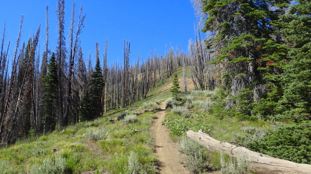
After a touch more climbing on the fire road, the single track climbing started through an old burn.
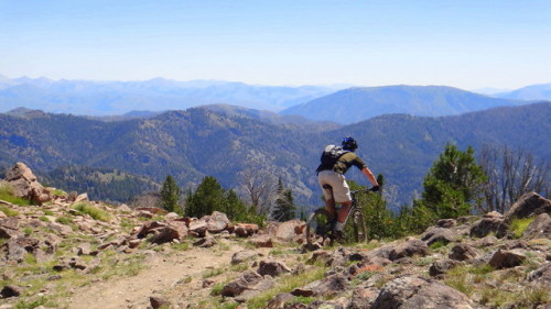
After riding just under Fox Peak, the downhill presented itself and I got a huge smile on my face anticipating the buff singletrack for which Sun Valley is known. And then, well, Upper Adams Gulch totally sucked. The descent started with a rather steep slip and slide through loose dirt. Which isn’t ideal, but it’s not out of the ordinary.
But what was utterly miserable was that the top section of the trail was completely overgrown. Most of the time, one could not even see more than a tire width across. Indeed, I crashed twice* trying to ride out overgrown creek crossings because I couldn’t see the other side.
* I’m a slow learner.
And, because this trail was comically unpleasant, a large part of the overgrowth was made up of stinging nettles which absolutely destroyed my shins. When the overgrowth finally started to back off in parts, the trail then became a scree field.

Finally, after an hour or so of that sufferfest, the trail opened up to the awesome single track for which Sun Valley is known. And after talking to several locals, I realized that no one rides the top part of Adams Gulch because it is so miserable. Live and learn.

Thankfully, the local Mexican restaurant — La Cabinita — was outstanding and I thoroughly enjoyed a wonderfully cold Bohemia and shrimp fajitas. A great end to a Type II fun Day.
Mahoney-Imperial
Trying to learn from our mistakes, we next hit one of the loops that everyone seemed to recommend. It was an easy spin through open meadows for a while.

Before we got to another old burn.

The trail ran along a marshy area, and marshy areas often mean moose. Hey, what do you know.

This big fellow was waiting for us right in the middle of the trail. For the record, moose are scary. And not David-has-a-totally-rational-fear-of-cows scary, but moose-seem-cute-like-hippos-but-then-you-learn-moose-like-hippos-kill-a-bunch-of-people scary. So we backed off and waited to see what he would do. We were past a reasonable turn around point so we had to wait him out or hike above him up a fairly steep gully. After what seemed like an eternity, we chose the later. And then Mr. Moose agreed to go off the trail as well.
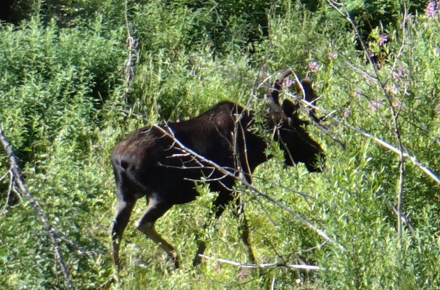
He smiled wide for the camera, lost interest in us, and went back to munching on some young aspens.

After we cleared the moose, it was back through the burn and some wildflowers.

After a few wrong turns, we finally hit the top and then dropped into amazing single track through alpine meadows and then forest.


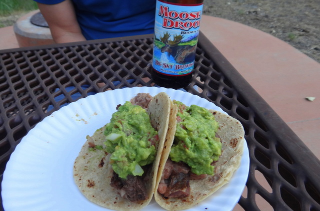
Back at the rig, we knew the perfect beer to accompany V’s carne asada tacos and fresh guac.
Osberg Ridgeline
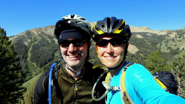
Day three sent us back up Baker Creek road to try out a new trail that had just opened on the Fourth of July — Osberg Ridgeline.
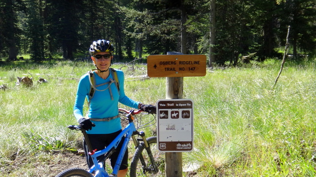
The trailbuilders had modified an old trail that went up and down (and up and down and up and down) the ridgeline in honor of Gloria Osberg, who published the first book about day hikes in Sun Valley. They did an outstanding job.
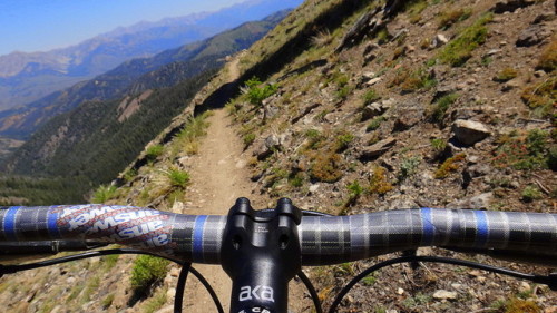
The trail climbed through the forest and then alpine meadows before hugging the ridgeline for the next ten plus miles.

In every direction, the views were jaw dropping.
The views continued to be amazing.

And the descents had enough exposure to keep you honest.
Even before we were done, we had stupid grins on our faces.
And even when we dropped off the ridge line back towards Tigger, V was still getting after it.

Fires drove us out of Idaho
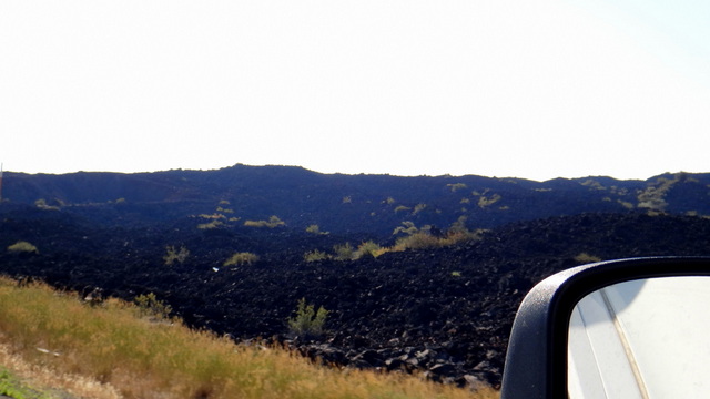
We woke up excited to hit some more rides further north in the Sawtooths near Stanley but were greeted by this sight on the drive north:
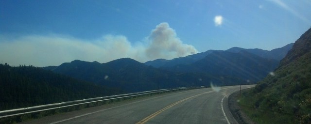
The only road through the Sawtooths was closed, and the major recreation area (where we had planned to spend the night) — Redfish Lake — had been evacuated due to the fire. Two more fires had started (separately) in areas surrounding the next two rides on our list. Not wanting to be in the way of emergency personnel — and not wanting to breath in all that smoke even if the fires were contained — we back tracked through Sun Valley then headed to Montana.
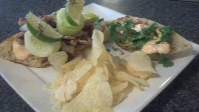
On the way, we had an amazing lunch in Salmon, ID at Junkyard Bistro. This place looks like every dive bar you’ve seen in Montana — and many of the clientele at the bar are also what you would typically find at the same. But in the world’s smallest gourmet kitchen — with five tables in back — the chef made amazing dishes, including V’s Banh Mi and my chicken parm sandwich. It’s amazing.
In want of some water after all that smoke (and burned forest), V and I headed to Lake Como.
Lake Como, Montana. See, e.g., Paris, Texas.
Lake Como is a high alpine lake in the Southwest corner of the Bitterroot Valley of Montana. It is stunning, and we parked on it’s shores and busted out the paddleboards.
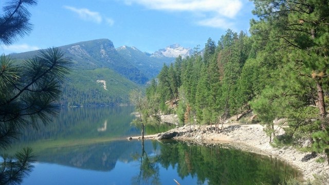
The area was quiet, the scenery amazing, and the water was the perfect temperature.


The natives were friendly and intrigued by our boards.

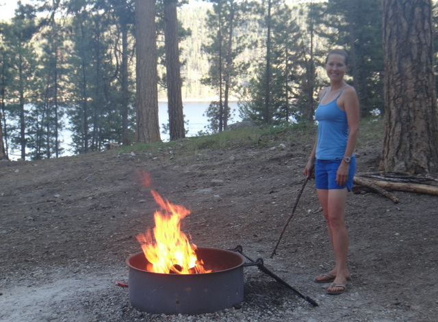
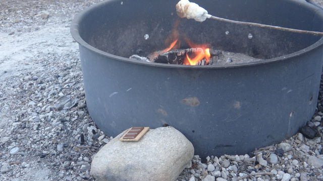
Which allowed us to make s’mores for the first time all trip via the Gooding Method.


Not content with the s’mores, we hit the local ice cream shop in Hamilton, MT in honor of our marshy friend before saying goodbye to Montana and heading even further north.
